


NISAR Satellite: NASA-ISRO Cooperation to Monitor Earth from Space
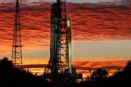
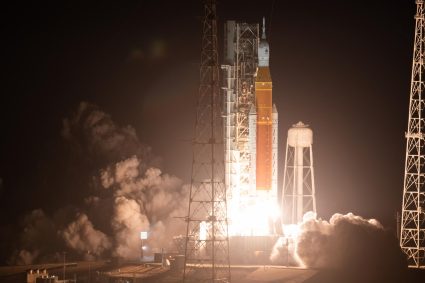
The NISAR (NASA-ISRO Synthetic Aperture Radar) satellite represents one of the most significant space collaborations between the United States and India. The result of a partnership between NASA and the ISRO (Indian Space Research Organisation), this satellite was successfully launched on July 30, 2025, from the Satish Dhawan Space Centre. Its primary mission is to provide high-resolution radar data to monitor dynamic changes on Earth’s surface—a crucial endeavor in the face of climate change, rapid urbanization, and increasing natural hazards.
NISAR Satellite Overview
The name NISAR stands for NASA-ISRO Synthetic Aperture Radar, highlighting the joint involvement of the two agencies. It is the first orbital radar satellite to carry radars operating simultaneously in the L-band and S-band—a unique configuration worldwide that will provide images of exceptional precision, regardless of weather conditions.
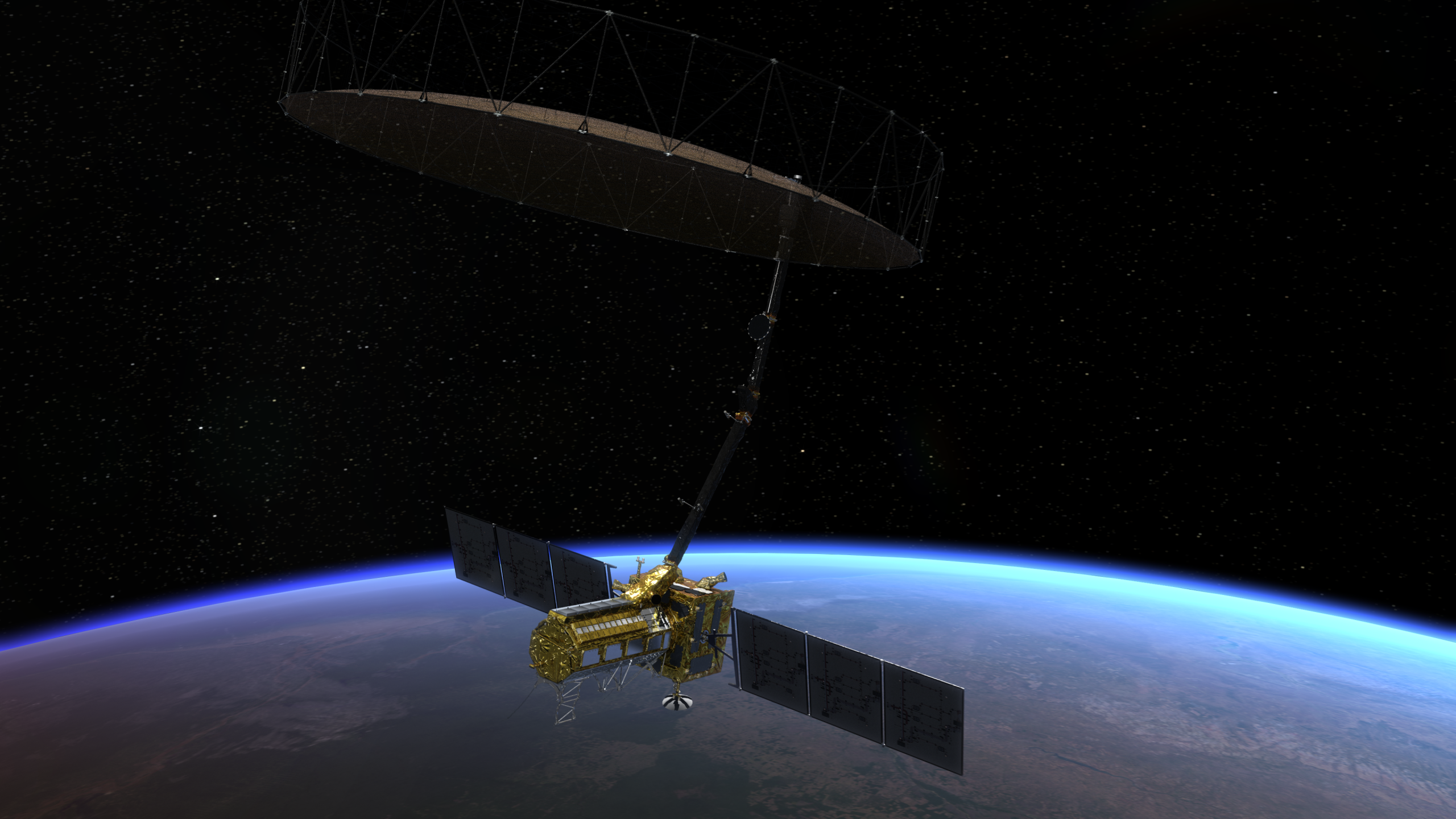
Animation showing how NISAR uses its radars
From a technical standpoint, the satellite is built on an ISRO I-3K platform, three-axis stabilized, and features an impressive 12-meter-diameter radar antenna, deployed once in orbit. It follows a sun-synchronous orbit at about 747 kilometers in altitude, ensuring consistent and repeated global coverage. It will pass over every point on Earth every 6 to 12 days, depending on orbital geometry. Designed to operate for at least three years, the satellite has the resources needed to extend its mission to up to five years.
Deployment of NISAR’s radar boom and radar reflector
Scientific Objectives and Main Missions
NISAR’s primary objective is to study the physical transformations of Earth’s surface by precisely mapping even the slightest ground movements. This capability is essential for monitoring seismic zones, volcanoes, landslides, and deformations caused by human activities such as resource extraction or infrastructure construction.
The mission will also play a key role in studying the cryosphere (ice sheets, glaciers, permafrost), the biosphere (forests, vegetation, biomass resources), and the hydrosphere (groundwater, aquifer levels, droughts). By combining high-frequency radar data, scientists will be able to observe long-term climate trends and anticipate certain effects of global change.
The data collected by NISAR will be made accessible worldwide. Outside of emergency cases, it will be available free of charge within 1 to 2 days. In the event of natural disasters, priority will be given to rapid data transmission to support relief operations and local governments.
A Strategic Cooperation Between NASA and ISRO
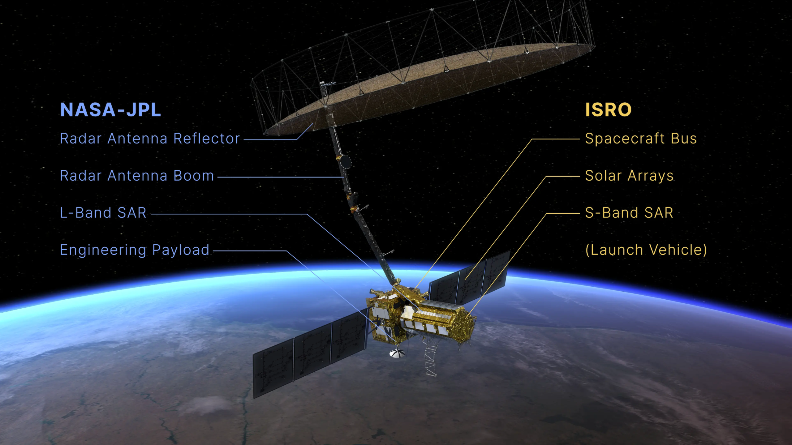
The NISAR mission is also a remarkable example of technological cooperation between two space powers. NASA developed the L-band radar as well as equipment for navigation, communications, and data processing. ISRO provided the satellite platform, the S-band radar, and the GSLV-F16 launch vehicle used to place it into orbit.
This partnership is part of a broader dynamic of cooperation between the two countries, which have previously worked together on scientific missions but never on such a scale. The project, with a total cost estimated at around $1.5 billion, strengthens not only scientific ties but also diplomatic relations between the two nations.
The NISAR satellite embodies a shared ambition between NASA and ISRO to better understand and protect our planet. Through its cutting-edge technology and collaborative model, it stands as a major milestone in space exploration in the service of Earth. In the coming years, its data could prove essential for addressing the major climate, environmental, and humanitarian challenges of the 21st century.
Source
NASA’s dedicated NISAR page is available here, and ISRO’s NISAR page is available here.